This post by Leigh McAdam was originally published on the Travel Alberta blog.
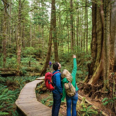
The start of winter doesn’t mean you need to stop hiking. In fact, the snow and ice adds a special kind of magic that you can’t find in summer. Just make sure to prepare properly. Dress in layers so you can adjust your temperature as needed, and think about your footwear. Some trails are light on snow, so hiking boots are best, while others require snowshoes (unless you think swimming through waist-deep powder all day is fun (actually, it kind of is).
We’ve identified a dozen of the most memorable winter hikes in Alberta, arranged by our footwear recommendation. Just be sure to check conditions before you head out.
Rawson Lake
The trail to Rawson Lake starts simply enough. The first 15 minutes is flat, easy snowshoeing along the shoreline of Upper Kananaskis Lake with spectacular views to the mountains beyond. But once you pass the Sarrail Waterfall, easy is over. The 985 foot climb through spruce forest to the lake is a stiff one. When it starts to moderate you know the lake isn't far off. Find a flat spot to enjoy lunch with a view of 12,188 foot Mount Sarrail. Just don’t venture beyond the near end of Rawson Lake as its avalanche terrain. The return is fun and fast.
How to get there: Follow Highway 40 south into Peter Lougheed Provincial Park. Continue past the turnoff to the Smith Dorrien Trail, staying on the Kananaskis Lakes Trail until you reach the Upper Kananaskis Lakes parking lot.
- Trailhead: Located at the Upper Kananaskis Lakes day use parking area
- Distance (return): 4.97 miles
- Time (return): 3 – 5 hours
- Elevation gain: 1000 feet
Troll Falls
A perennial favorite, the easy hike to ice-covered Troll Falls offers a surprising amount of variety over its short length. Even with a web of trails in the area, the route to the falls is a snap to find. Hike through dense evergreen forest on a wide trail to reach a beautiful section of open aspens. Then take a narrow trail that snakes along the left bank of Marmot Creek where debris from the 2013 floods is still visible.
Reach the blue-colored U-shaped falls at the end of the trail. For otherworldly views, poke in behind the falls, just be sure to take ice-cleats to do this.
How to get there: Take Highway 40 south to the Kananaskis Village turnoff also called Mt. Allan Drive. Follow the road for just over half a mile, past the first junction, turning right into the Stoney Trail parking lot.
- Trailhead: Stoney Trail parking lot
- Distance (return): 2.1 miles
- Time (return): 1 – 2 hours
- Elevation gain: 196 feet
Prairie Mountain
If you want a workout that mimics a stairclimber at the gym, do the ever-popular and dog-friendly hike up Prairie Mountain. It starts steeply and stays that way until you clear the trees; then it moderates all the way to the constantly windy summit. The reward on top – a rush of happy hormones and far-reaching mountain and prairie views, including Calgary. It will definitely be a test of your conditioning program (or lack thereof). Add this year-round hike as training for bigger peaks come the summer. Don’t forget the ice cleats for the descent.
How to get there: From Calgary, take the Cowboy Trail (Highway 22) past Bragg Creek to the intersection with Highway 66. Continue on Highway 66 to reach the Elbow Falls parking lot.
- Trailhead: Look for the trailhead across from the Elbow Falls parking lot by the winter gates.
- Distance (return): 4.7 miles
- Time (return): 2.5 – 4 hours
- Elevation gain: 2,381 feet
Johnston Canyon
Strap on a pair of ice-cleats to start your Johnston Canyon adventure. Over 1.7 miles, hike into a world of frozen creeks and waterfalls accessed via a cantilevered catwalk through a spectacular canyon that would otherwise be off-limits. At the Lower Falls be sure to cross the bridge and duck through a tunnel to get an intimate view of a frozen icefall. Back on the trail, gain elevation as you continue towards the Upper Falls. This section offers airy outlooks and numerous photo opportunities into the gorge below. At the Upper Falls, marvel at the cathedral of ice and watch ice-climbers in action.
How to get there:Take the Bow Valley Parkway west for 10.8 miles from the eastern interchange with the Trans-Canada Highway
- Trailhead: Located near the rear of the parking area on the east side of the Bow Valley Parkway
- Distance (return): 3.2 miles
- Time (return): 2 – 2.5 hours (including the Upper Falls)
- Elevation gain: 393 feet
Tunnel Mountain
Put the Tunnel Mountain hike on the must-do list if you’re visiting Banff. Over a couple of hours, not only will you get a moderate workout but you’ll get the lay of the land from above. On the moderate climb up, enjoy exceptionally panoramic views of the Banff townsite, the Bow Valley including the extensive marshes, the Mt. Norquay ski area along with an almost aerial overview of the Fairmont Banff Springs Hotel. Loop around the summit and Mt. Rundle will stare you in the face. Take five on the summit and relish the world-class view.
How to get there: Take Banff Avenue to Wolf Street and go east until the end of the road. Turn right onto Grizzly and an immediate left onto St. Julien Road. Follow it to the Tunnel Mountain
- Trailhead: lower parking area (note: in winter start at the signed lower parking area).
- Distance (return): 2.9 miles
- Time (return): 90 mins – 2 hours
- Elevation gain: 853 feet
Elk Island National Park
Discover a winter wonderland when you explore Elk Island National Park on snowshoes. Ten hiking trails covering 50 miles convert to snowshoe trails in winter. Most are loops with easy ones like the 2.2 mile Simmons Trail taking just an hour while the full 10.25 mile loop around Tawayik Lake will take five. The landscape is diverse with lots of meadows, frozen lakes and mixed forests of aspen, poplar and spruce. To increase your chances of seeing moose, elk or bison, stop at the Visitor Centre (where you can rent snowshoes) for its up-to-date intelligence on animal locations.
How to get there: Take Highway 16 East from Edmonton for about 35 minutes. Look for signs pointing to Elk Island National Park with the main entrance to the north.
- Trailhead: Check with park staff for their suggestions based on trail conditions.
- Distance (return): Variable
- Time (return): 1 hour – a full day depending on the trail
- Elevation gain: Minimal
Spray River Trail
The Spray River Trail, located mere steps from the Fairmont Banff Springs Hotel, offers an easy outing on snowshoes. The forest walking is pretty alongside the turquoise-colored waters of the Spray River. The occasional view of Mt. Rundle keeps it interesting. There is the option to continue past the bridge 3.5 miles in for an epic hike to the Goat Creek Trailhead. But most people turn around here. While you can retrace your steps, a loop back on the other side of the Spray River is the superior choice. If you do this keep an eye out for ice-climbers high up on frozen waterfalls.
How to get there: Drive past the Banff Springs Hotel and continue straight past the parkade for about 328 feet to a parking lot signed for users of the Spray River trails.
- Trailhead: Spray River parking lot
- Distance (return): 7 miles if you go all the way to the bridge
- Time (return): 3 – 4 hours
- Elevation gain: 213 feet
Badlands Interpretive Trail, Dumheller
Head to the Royal Tyrrell Museum in Drumheller to do the short, easy and extremely beautiful Badlands Interpretive Trail. While hardly a wilderness outing, it exposes you to the winter beauty of the hoodoos, coulees and eroded rock formations. Enthusiastic hikers will want more. From the Interpretative trail take an obvious spur trail that links to the extensive Drumheller River Parks System. Enjoy the drama of the badlands all the way to the highway. Once there, either retrace your steps or continue for as long as you like in either direction along the scenic Red Deer River.
How to get there: From Drumheller look for signs pointing to the Royal Tyrrell Museum. Take Highway 838, the North Dinosaur Trail for approximately 3 miles.
- Trailhead: Start on the far side of the main entrance to the Royal Tyrrell Museum
- Distance (return): 0.6 miles minimum
- Time (return): 30 minutes – as many hours as you’d like
- Elevation gain: Negligible
Glenbow Ranch
Historic Glenbow Ranch is laced with trails running from the fringes of Cochrane to the edge of Calgary. Have a look at the map at the Visitor Centre to mount a plan. With trails running the gamut from flat to hilly, and from loops to out-and-back hikes, time will be the decider. Navigation is easy with maps at all intersections. Trails are dog-friendly too. If you want an up-close experience with the frozen Bow River try the combination of the Glenbow Trail and the Bow River Loop. If it’s Rocky Mountain views you’re after, head for the Windmill Lookout.
How to get there: From Calgary, take Glenbow Road south off of Highway 1A. Signage is visible from the highway. It’s 10 minutes from Cochrane, 30 minutes from Calgary.
- Trailhead: From the parking lot follow signs and pathways to the Visitor Centre.
- Distance (return): Highly variable
- Time (return): 1 – 5 hours
- Elevation gain: Depends on the trails you do
Waskasoo Park, Red Deer
Approximately 62 miles of trails weave through Waskasoo Park, primarily along the Red Deer River with most trails leaving you feeling far removed from a city. There are two standout places to start snowshoeing or hiking; the Kerry Wood Nature Centre with its three miles of trails and excellent opportunities for bird and nature viewing, or the Red Deer Tourism office. From the office take the woodsy trail through rolling hills to the McKenzie Trail Recreation area, formerly the site of gravel pits. If you have energy to burn continue to the Bower Ponds. Refuel at The Maple Tree Bakery and retrace your steps.
How to get there: Drive to the Tourism Red Deer Centre beside the Alberta Sports Hall of Fame on Highway 2 and pick up a trail map for Waskasoo Park.
- Trailhead: Numerous access points including the Kerry Woods Nature Centre, Balmoral Ponds and the Visitor Information Centre on Highway 2
- Distance (return): Highly variable
- Time (return): As much time as you have
- Elevation gain: Minimal
Maligne Canyon
Maligne Canyon is the deepest accessible canyon in Jasper National Park. While it can easily be done as a self-guided excursion (wearing ice cleats), you get the full benefit of the experience if you do a tour. Squirm head first into a cave serious spelunkers explore. Slip in behind a frozen waterfall and gaze out through ghostly layers of ice. Observe icicles the size of a grown human. Look for ice-climbers in action on the largest icefall at the end of the canyon. But most of all, be amazed by the beauty of frozen waterfalls and unbelievable ice formations.
How to get there: From the town of Jasper, take Highway 16 east to the Maligne Lake Road, 1 mile east of the Connaught Drive intersection. On Maligne Lake Road turn left at the fifth bridge sign or continue for another 3.8 miles and turn left into the Maligne Canyon parking lot at the first bridge. If you take a tour, you get driven to the start point.
- Trailhead: Most ice walks start at the fifth bridge.
- Distance (return): 2.5 miles
- Time (return): 1- 3 hours depending if you do a tour
- Elevation gain: NA
Chester Lake (Snowshoes)
On a bluebird day, one of the prettiest snowshoeing outings in Alberta is the one to Chester Lake. Expect company as this trip is worthy of an annual visit. The reason – truly exceptional mountain views once you reach the meadows and consistently excellent snow. The trail, shared for 656 feet with cross-country skiers, starts off steeply in the woods for the first few miles, then moderates when you reach a large meadow. The grade is gentle the rest of the way to Chester Lake. If you have time to explore, take the steep trail from Chester Lake to Elephant Rocks where giant-sized boulders lay scattered helter-skelter.
How to get there: Follow the Smith Dorrien Trail (Hwy 742)/Spray Lakes Road for 23 miles past the Canmore Nordic Centre. From the other direction, take Highway 40 to the Smith Dorrien Trail and follow it for 14.5 miles. A large parking lot is on the east side of the highway.
- Trailhead: Chester Lake parking lot
- Distance (return): 6.2 miles
- Time (return): 3 – 5 hours
- Elevation gain: 942 feet